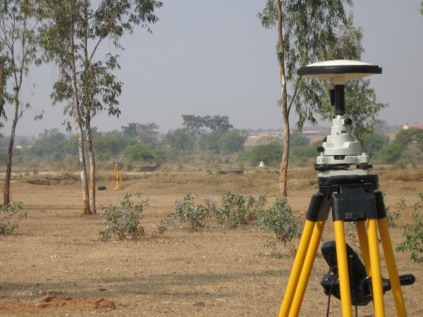
In today’s world where the concrete forest is taking place at a faster rate, it is necessary to map curves and make sure that the land is safe to use for staying purpose. Such type of survey is called Topographical Survey in which the identification is done and the curves of the ground are well maps out to understand which surface of the earth is the strong one and is above or below the surface such as stress, buildings, walkways, trees, and even the utility poles. The ideal purpose of such type of survey is to make sure that base mapping of the residence or building design is done in appropriate manner and the boundary lines parameters are set in a right way.
Who needs the Topographical Surveys?
It is mostly used by builders, homeowners, and even the business owners who look forward to renovate their property in a right manner. Such type of survey is considered to be the main step before initiating any other major step such as renovating a property or expanding a property, or starting with any other construction proves. The main reason is it offers the best solution and a clear picture about the surrounding land.
Uses of Topographical Surveys :
Capture the features : Topographical Surveys ensures that the natural and manmade feature of a certain area of the land is well identified and recorded. There are many surveys that might have seen in which mapping is done with the help of a particular landmark or the stakes. However, in case topographic survey the use of EDM and GPS technology is made. Due to which the mapping can be seen for the contour lines along with identifying the changes in the land that might have taken place over a span of time.
Make decision : It is necessary to perform such type of survey because it helps to make an accurate decision on whether the existing property needs to be changed or the entire building must be simply renovated. It is considered to be the brief idea to which the information of the surface, curves and even the underground utilities are associated with each other.
Serve the purpose of Historical data : Topographical Survey is also a better platform to understand and decide on the data which has been collected and which can also be analyzed and weighed once all the factors are set that needed to be assumed before planning and designing. Such type of survey also adds up the historical data by which a base map can be used for conceptualizing and understanding the actions which needs to be taken in the management.
Such type of survey is always done by the expert who holds years of experience in conducting such mapping process. In case, you are want to get it done before starting with the residential or other property construction then your job is to ensure that you get it done from the expert. In recent times, with the advancement in technology even the advanced surveying has come up that gives more precise insight of the measurement. Such surveys are important to record the historical data, documents, and maps associated with the property and ensure that the land usage is done in a right manner irrespective of the project undertaken.

